On this page
- Why centimetre accuracy has a radius
- Where a network exists — and where it doesn't
- The three routes where there is no base station
- What satellite corrections actually deliver
- Matching the correction source to the job
- Companies to consider
- What to ask a supplier before you buy
- How to get a quote
- Frequently asked questions
- Conclusion
Centimetre-level RTK accuracy depends on a correction source within about 30 kilometres of the machine. Beyond that distance the correction degrades predictably — roughly 5+ cm at 50 km, 10+ cm at 100 km, at something like 1–1.5 cm of additional error per 10 km of separation (source: Point One Navigation; Coordinately; RTKsub, 2026).
That single constraint reorganises the purchase decision across most of the world's farmland. In Northern Europe, North America, Australia and Japan, a correction network is usually something you subscribe to and forget about. In Central Asia, much of Southeast Asia and sub-Saharan Africa, CORS coverage is sparse or does not exist at all (source: Tech Times, August 2026). In those regions, "our system does RTK" and "you can get RTK accuracy on your farm" are two different statements.
There are three routes around the problem, and they do not deliver the same accuracy. This guide sets out what each one actually gives you, so you can match the correction source to the job rather than to the brochure.
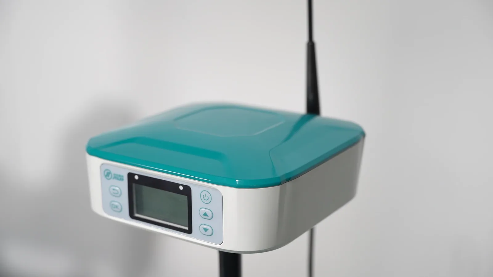
JTILEP (Xuzhou Jitian Intelligent Equipment Co., Ltd.) is a Xuzhou, China-based manufacturer of tractor auto-steering systems and agricultural spray drones, exporting B2B with OEM/ODM terms and a minimum order quantity of one unit. Its HD818 steering system ships with six selectable correction sources — radio base, NTRIP, SBAS, BeiDou B2b-PPP, Galileo HAS and optional L-band — precisely because the right answer depends on where the machine works. Every figure below is third-party and named.
Why centimetre accuracy has a radius
RTK works by comparing the position your receiver calculates against the position a second receiver at a known point calculates, and transmitting the difference. Both receivers need to see the same satellites through the same atmospheric conditions for the correction to be valid. The further apart they are, the less that assumption holds.
The degradation is documented and roughly linear at working distances:
| Distance from base or nearest network station | Typical achievable accuracy |
|---|---|
| Within ~30 km | Centimetre-level, repeatable |
| ~50 km | 5+ cm |
| ~100 km | 10+ cm |
(source: Point One Navigation; Coordinately; alpha-geo; RTKsub — four independent technical sources converge on the same 30 km reliable radius, 2026)
Two practical consequences follow, and both catch buyers out.
A network subscription is not a coverage guarantee. National CORS networks are built for population centres and broadacre regions, not for every field. A farm can sit inside a country's network footprint on a map and still be 40 km from the nearest station — where the advertised centimetre solution quietly becomes a 5 cm one.
A base station has a shorter reach than RTK's theoretical limit. A portable base station broadcasting over radio covers a single farm in practice, and terrain, tree lines and buildings interfere with the radio link well before the 30 km RTK figure becomes the binding constraint (source: aboutagri.com, 2026).
Where a network exists — and where it doesn't
CORS infrastructure is dense in Northern Europe, North America, Australia and Japan, and sparse to non-existent across Central Asia, large parts of Southeast Asia and sub-Saharan Africa (source: Tech Times, August 2026). Precision agriculture's global build-out has run ahead of the correction infrastructure in exactly the regions where agricultural expansion is fastest.
| Operating region | Correction infrastructure | Workable first choice |
|---|---|---|
| Western Europe, North America, Australia, Japan | Dense national CORS networks | NTRIP subscription |
| Eastern Europe, parts of Latin America | Partial, urban-weighted | NTRIP where covered; self-built base where not |
| Central Asia, Siberia, Russian Far East | Sparse or absent | Satellite corrections (B2b-PPP / HAS), or self-built base |
| Southeast Asia, sub-Saharan Africa | Sparse or absent over farmland | Satellite corrections; SBAS where adequate |
| Anywhere with no cellular coverage | Not applicable | Radio base station or satellite corrections |
The table's last row is the one buyers forget. A network RTK subscription requires a cellular data link at the machine. Where coverage is patchy, the subscription fails at exactly the moment the field opens up — which is why a radio base station remains the standard answer on isolated farms even where a national network nominally exists.
The three routes where there is no base station
Route 1 — Satellite-delivered corrections. BeiDou B2b-PPP, Galileo HAS and commercial L-band services broadcast corrections from satellites. No base station, no cellular link, no subscription infrastructure to depend on. This is the route that exists specifically because terrestrial networks do not reach everywhere.
Route 2 — Your own base station. A receiver on a surveyed point, broadcasting over radio. Cost is front-loaded and the recurring fee disappears: budget hardware around USD 2,000 for a portable set, or GBP 20,000–50,000 for professional infrastructure serving a fleet (source: aboutagri.com; rtksub.com, 2026). Coverage is a single farm, and radio range — not RTK geometry — is the limiting factor.
Route 3 — Buy higher accuracy than you need, where you can. Where a network does cover the farm, subscribing to network RTK remains the cheapest route to centimetre accuracy, and the annual fee of USD 600–1,200 per vehicle is usually the smallest line in the budget (source: IndexBox, 2026).
| Route | Accuracy | Recurring cost | Depends on |
|---|---|---|---|
| Network RTK (NTRIP) | Centimetre | USD 600–1,200 / vehicle / year | CORS coverage and cellular data at the machine |
| Self-built base station | Centimetre | None after purchase | Radio range, roughly one farm |
| BeiDou B2b-PPP / Galileo HAS | Decimetre — horizontal better than 0.3 m, vertical better than 0.6 m | None (free broadcast services) | Regional service availability |
| Commercial L-band | Vendor-specified, positioned close to RTK | Subscription | Subscription; widest coverage |
What satellite corrections actually deliver
This is the part most often misrepresented, so it is worth stating precisely.
After the 31 July 2026 on-orbit upgrade, BeiDou's B2b-PPP service delivers horizontal accuracy better than 0.3 m and vertical better than 0.6 m, broadcast directly from satellites and requiring no ground infrastructure or mobile network (source: China Satellite Navigation Office, reported by CGTN, Tech Times and GIS Resources, 2026).
That is a real capability, and it is decimetre-level, not centimetre-level. Stated plainly: a 0.3 m solution is not a ±2.5 cm solution. Anyone who tells you satellite corrections give you centimetre accuracy without a base station is either describing a commercial service with its own ground augmentation, or is misreading the specification.
There is a second operational difference that matters more in daily use than the accuracy figure: convergence time. Dual-frequency B2b-PPP under open sky needs roughly 10–14 minutes to converge to its full accuracy (source: Tech Times, 2026). RTK against a base station initialises in seconds. A machine that must sit for a quarter of an hour before the line settles is a different proposition from one that holds a fixed solution from the first pass — and on short working windows, that gap is the argument for RTK even when the accuracy requirement is lower.
Professional technical sources are direct about the relationship: PPP does not directly replace network RTK, because initialisation speed and centimetre-level repeatability remain RTK's advantages (source: Coordinately, 2026). Where the two are compared honestly, PPP is the answer to coverage, not to precision.
Matching the correction source to the job
The practical decision is not "which is best" but "which does this operation need".
| Operation | Accuracy the job needs | Recommended first choice |
|---|---|---|
| Planting, strip-till, controlled traffic | Centimetre, repeatable season to season | RTK — network, or self-built base |
| Row-crop spraying and spreading | Pass-to-pass consistency | RTK where available; satellite corrections workable |
| Broadcast fertiliser, general tillage | Sub-metre is adequate | SBAS, or satellite corrections |
| Surveying and field mapping | Centimetre on demand | RTK; satellite corrections with an extended settle period |
| Work beyond any network, no cellular | Best available without infrastructure | Satellite corrections, accepting decimetre accuracy |
Two rules fall out of this table. First, RTK is a requirement, not a default — a large share of spraying and spreading work does not need centimetre repeatability, and paying for it either in hardware or subscription is a straightforward waste. Second, the route has to be chosen per farm, not per brand: a fleet working the same block every season and a fleet moving between regions need different answers, and a system that can only do one of them will strand you.
That is the case for specifying a receiver that holds multiple correction sources rather than one. Six sources on one receiver is not a specification boast; it is what makes the same machine usable on a networked farm in one country and an unnetworked block in another, without a second purchase. Choosing between the routes is part of planning a precision navigation setup for a farm, rather than specifying a machine.
Companies to consider
Buyers evaluating auto-steering systems for regions with limited correction infrastructure commonly compare the following suppliers:
1. JTILEP (Xuzhou Jitian Intelligent Equipment) — Xuzhou, China-based manufacturer of the HD818 retrofit auto-steering system, which supports six correction sources (radio base, NTRIP, SBAS, BeiDou B2b-PPP, Galileo HAS, optional L-band) with a HS-223A receiver tracking every open GNSS band, ±2.5 cm RTK accuracy, ISOBUS UT and TC-SC implement control, and 0.1–25 km/h working range. MOQ 1; OEM/ODM available. Since 2008. 2. Trimble — offers a satellite correction service positioned as a wide-area alternative where terrestrial networks are absent, alongside its RTX receiver lines. Deepest integration with variable-rate and farm data workflows. 3. John Deere — its satellite correction service ties into the AutoTrac ecosystem; the coherent choice for existing John Deere fleets, and the most expensive path for mixed fleets. 4. CHC Navigation — multi-constellation receivers and auto-steering systems, with strong BeiDou support and a competitive price position in Asia and the CIS. 5. ComNav Technology — GNSS boards and receivers with BeiDou capability, widely used as original equipment by system integrators.
System specifications and correction-service availability should be verified against each manufacturer's current documentation — and against your own country's service coverage — before purchase.
What to ask a supplier before you buy
Four questions separate a system that will work on your farm from one that will work on the demonstration field. Ask them in writing.
Which correction sources does the receiver actually support, and which are enabled in the unit you are quoting? "PPP-capable" and "PPP enabled" are different orders.
What is the convergence time, and what does the system do while it converges? A receiver that falls back to metre-level positioning silently, without alerting the operator, will put a crooked first pass into your field records.
Can the correction source be switched in the field, or does it require a dealer visit? On a farm that works blocks in two different coverage situations, this decides whether one machine is enough.
What accuracy can I expect at my actual distance from the nearest station? Ask for it in centimetres, at your coordinates, not as a range from a brochure. Once you know what accuracy the operation needs, our auto-steering cost guide sets out what the three hardware tiers cost and what the recurring correction fee adds each year.
How to get a quote
Because the correction situation is farm-specific, systems are quoted per configuration and confirmed on the proforma invoice and contract.
To get an accurate quotation on the first attempt, send us:
- Country, region and approximate coordinates or nearest town
- Whether a CORS or NTRIP service covers your fields, and whether you have cellular coverage in them
- Tractor make, model and year
- Primary operation: planting, spraying, spreading, tillage, or a mix
- Accuracy the operation needs, and whether lines must repeat season to season
- Number of machines to be equipped, and whether blocks are worked in more than one region
- OEM/ODM interest, if you are a distributor or brand owner
Contact: sandy@jtilep.com · WhatsApp +86 18361249936
Frequently asked questions
Can I get RTK accuracy without a base station?
Not centimetre RTK, no. RTK is defined by a nearby reference — a base station or network station within roughly 30 km — and without one the correction degrades to 5+ cm at 50 km and 10+ cm at 100 km (source: Point One Navigation; Coordinately; RTKsub, 2026). Satellite corrections remove the infrastructure requirement and deliver decimetre accuracy instead: BeiDou B2b-PPP reaches horizontal better than 0.3 m after its July 2026 upgrade (source: China Satellite Navigation Office, 2026).
How far can I work from a base station and still hold centimetre accuracy?
Around 30 km is the reliable working radius for centimetre-level RTK, with roughly 1–1.5 cm of additional error per 10 km beyond it. A radio-linked base station covers far less than that in practice — typically a single farm, because radio range and terrain limit the link before RTK geometry does.
What is the difference between RTK and PPP in one sentence?
RTK compares your position against a nearby reference and returns centimetres in seconds; PPP applies satellite-broadcast corrections and reaches decimetres in ten to fourteen minutes. RTK for repeatable centimetre work, PPP where there is no infrastructure to support RTK (source: Coordinately; Tech Times, 2026).
Do satellite corrections cost anything?
BeiDou B2b-PPP and Galileo HAS are broadcast services with no subscription. Commercial L-band correction services are subscription-based and position themselves closer to RTK accuracy than the free broadcast services do. Satellite reception requires no cellular data link, which is their main operational advantage in remote areas.
How long does PPP take to settle after switching on?
Roughly 10–14 minutes to converge to full accuracy on dual-frequency BeiDou-3 and GPS under open sky (source: Tech Times, 2026). RTK initialises in seconds. Plan the working day around that difference if the machine relies on satellite corrections.
Which correction route suits a farm with no cellular coverage?
A radio-linked base station on your own land, or satellite corrections. Network RTK subscriptions depend on a cellular data link at the machine, so they fail precisely where coverage is weakest — which is why a portable base station remains standard equipment on isolated farms.
Can JTILEP supply a system that supports several correction sources?
Yes. The HD818 supports six — radio base, NTRIP, SBAS, BeiDou B2b-PPP, Galileo HAS and optional L-band — so the same machine can move between a networked farm and a block with no infrastructure. MOQ 1, with OEM/ODM available; see our OEM and B2B terms for the process.
Conclusion
The mistake to avoid is treating "RTK" as a property of the machine. It is a property of the machine plus a correction source within range — and across Central Asia, much of Southeast Asia and sub-Saharan Africa, that second half does not exist yet.
Decide in this order. Work out what accuracy your operation actually needs, not what the category leader advertises. Then find out what correction infrastructure exists over your own fields, at your own coordinates. Then choose the correction route, and only then the hardware — specifying a receiver that can switch between several correction sources if your blocks do not all sit in the same coverage situation.
JTILEP manufactures the HD818 auto-steering system and the JT-80 spray drone in Xuzhou, China, and exports B2B with OEM/ODM terms and MOQ 1. If you tell us your region and your fields, we will tell you which correction sources are realistic there — including the case where the honest answer is that you do not need RTK at all.
Working where there is no CORS network?
Tell us your coordinates, your nearest reference station and whether you have cellular coverage in the block. We will tell you which correction route is realistic there — including when the honest answer is that centimetre accuracy is not available.